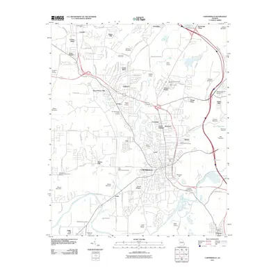
2011 Map of Cartersville
USGS Topo · Published 2011About this map
Cartersville sits at the heart of this landscape, where the Etowah River bends around Reservoir Hill and the industrial corridors of Junta and Atco define the urban fabric. The map captures the city during a period of modern expansion, evidenced by the growth of suburban enclaves like County Manor and Mission Hills. The survey is particularly dense with genealogical data, documenting numerous family burial grounds such as the Guyton Family Cemetery, Dobbs Family Cemetery, and Rowland Family Cemetery.
Find a feature on this map
111 named features on this map. Tap any name to fly to it.
Don’t see what you’re looking for? This feature index may not catch every label — zoom into the map to look around manually.
Map Details
Editions of this 2011 Cartersville Map
This is the sole edition of this map. No revisions or reprints were ever made.
Other maps of this area

1890 · Cartersville
USGS Topo · 1:125,000

1891 · Cartersville
USGS Topo · 1:125,000

1896 · Cartersville
USGS Topo · 1:125,000

1906 · Stilesboro
USGS Topo · 1:62,500

1907 · Acworth
USGS Topo · 1:62,500

1908 · Stilesboro
USGS Topo · 1:62,500

1909 · Acworth
USGS Topo · 1:62,500

1941 · Adairsville
USGS Topo · 1:62,500

1944 · Adairsville
USGS Topo · 1:62,500

1947 · Waleska
USGS Topo · 1:62,500