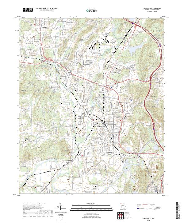
2024 Map of Cartersville
USGS Topo · Published 2024About this map
Cartersville serves as the central hub of this modern survey, anchored by the Bartow County Courthouse and surrounding neighborhoods like Atco, Junta, and Rodgers. The landscape is a complex mix of urban development and prominent topography, defined by the winding Etowah River and its sharp turn at Rowlands Bend. Numerous family and community burial grounds, including the Guyton Family Cem and the extensive Oak Hill Cem, provide significant touchpoints for genealogical research.
Find a feature on this map
51 named features on this map. Tap any name to fly to it.
Don’t see what you’re looking for? This feature index may not catch every label — zoom into the map to look around manually.
Map Details
Editions of this 2024 Cartersville Map
This is the sole edition of this map. No revisions or reprints were ever made.
Other maps of this area

1890 · Cartersville
USGS Topo · 1:125,000

1891 · Cartersville
USGS Topo · 1:125,000

1896 · Cartersville
USGS Topo · 1:125,000

1906 · Stilesboro
USGS Topo · 1:62,500

1907 · Acworth
USGS Topo · 1:62,500

1908 · Stilesboro
USGS Topo · 1:62,500

1909 · Acworth
USGS Topo · 1:62,500

1941 · Adairsville
USGS Topo · 1:62,500

1944 · Adairsville
USGS Topo · 1:62,500

1947 · Waleska
USGS Topo · 1:62,500