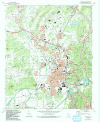
1992 Map of Cartersville
USGS Topo · Published 1993About this map
The Etowah Mounds State Historic Site anchors the southern reaches of this Bartow County landscape, where the ancient earthworks of the Indian Mounds sit in a bend of the Etowah River. By the early 1990s, the area reflects a complex transition from its industrial and agricultural roots to suburban expansion. The mill village legacy of Atco and the established streets of Cartersville are surrounded by significant mining activity, evidenced by numerous strip mines and a large Industrial Waste Pond near the river.
Find a feature on this map
69 named features on this map. Tap any name to fly to it.
Don’t see what you’re looking for? This feature index may not catch every label — zoom into the map to look around manually.
Map Details
Editions of this 1992 Cartersville Map
This is the sole edition of this map. No revisions or reprints were ever made.
Other maps of this area

1890 · Cartersville
USGS Topo · 1:125,000

1891 · Cartersville
USGS Topo · 1:125,000

1896 · Cartersville
USGS Topo · 1:125,000

1906 · Stilesboro
USGS Topo · 1:62,500

1907 · Acworth
USGS Topo · 1:62,500

1908 · Stilesboro
USGS Topo · 1:62,500

1909 · Acworth
USGS Topo · 1:62,500

1941 · Adairsville
USGS Topo · 1:62,500

1944 · Adairsville
USGS Topo · 1:62,500

1947 · Waleska
USGS Topo · 1:62,500