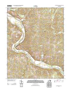
2013 Map of Cartersville
USGS Topo · Published 2013About this map
The James River defines the central character of this 2013 survey, winding through the Virginia landscape and separating the community of Cartersville from Pemberton. Large river features like Elk Island and Bolling Island emphasize the historical importance of the waterway for local commerce and geography. Evidence of earlier industry persists at Muddy Creek Mills near Tamworth, illustrating the region's long-standing reliance on local waterpower and milling.
Find a feature on this map
84 named features on this map. Tap any name to fly to it.
Don’t see what you’re looking for? This feature index may not catch every label — zoom into the map to look around manually.
Map Details
Editions of this 2013 Cartersville Map
This is the sole edition of this map. No revisions or reprints were ever made.
Other maps of this area

1890 · Goochland
USGS Topo · 1:125,000

1891 · Palmyra
USGS Topo · 1:125,000

1892 · Goochland
USGS Topo · 1:125,000

1895 · Palmyra
USGS Topo · 1:125,000

1897 · Palmyra
USGS Topo · 1:125,000

1943 · Goochland
USGS Topo · 1:31,680

1943 · Powhatan
USGS Topo · 1:31,680

1943 · South Anna
USGS Topo · 1:24,000

1943 · Richmond
USGS Topo · 1:250,000
1944 · South Anna
USGS Topo · 1:31,680