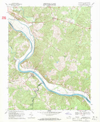
1969 Map of Cartersville
USGS Topo · Published 1971About this map
James River meanders through the heart of this Virginia landscape, marking the historic boundary between Goochland, Cumberland, and Powhatan counties. The Chesapeake and Ohio railroad follows the northern bank, serving small settlements like Pemberton and Elk Hill. On the opposite shore, Cartersville serves as a local focal point, accompanied by the Cartersville Cem and St James Ch. Large river islands, including Elk Island and Bolling Island, dominate the waterway, highlighting the complex alluvial geography of the Piedmont region.
Find a feature on this map
38 named features on this map. Tap any name to fly to it.
Don’t see what you’re looking for? This feature index may not catch every label — zoom into the map to look around manually.
Map Details
Editions of this 1969 Cartersville Map
3 editions found
Other maps of this area

1890 · Goochland
USGS Topo · 1:125,000

1891 · Palmyra
USGS Topo · 1:125,000

1892 · Goochland
USGS Topo · 1:125,000

1895 · Palmyra
USGS Topo · 1:125,000

1897 · Palmyra
USGS Topo · 1:125,000

1943 · Goochland
USGS Topo · 1:31,680

1943 · Powhatan
USGS Topo · 1:31,680

1943 · South Anna
USGS Topo · 1:24,000

1943 · Richmond
USGS Topo · 1:250,000
1944 · South Anna
USGS Topo · 1:31,680