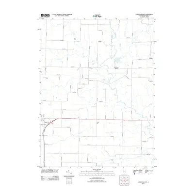
2012 Map of Carthage East
USGS Topo · Published 2012About this map
The La Moine River winds through the eastern Hancock County countryside, anchoring a landscape defined by its tributary creeks and rural homesteads. This area, east of the county seat, reveals a deep-rooted agricultural character where small private airfields like Lung RLA Airport and Brooks Ranch Airport serve the local community alongside a dense grid of county roads. Genealogists and local historians can find significant landmarks scattered across the township, including several well-preserved burial sites such as the Old Carthage Cem, Franklin Cem, and the McKay Cem to the north.
Find a feature on this map
67 named features on this map. Tap any name to fly to it.
Don’t see what you’re looking for? This feature index may not catch every label — zoom into the map to look around manually.
Map Details
Editions of this 2012 Carthage East Map
This is the sole edition of this map. No revisions or reprints were ever made.
Other maps of this area

1913 · Colchester
USGS Topo · 1:62,500

1918 · La Harpe
USGS Topo · 1:62,500

1932 · Lomax
USGS Topo · 1:62,500

1933 · Carthage
USGS Topo · 1:62,500

1937 · Carthage
USGS Topo · 1:62,500

1937 · Lomax
USGS Topo · 1:62,500

1958 · Burlington
USGS Topo · 1:250,000

1961 · Burlington
USGS Topo · 1:250,000

1963 · Burlington
USGS Topo · 1:250,000
1964 · Colusa
USGS Topo · 1:24,000