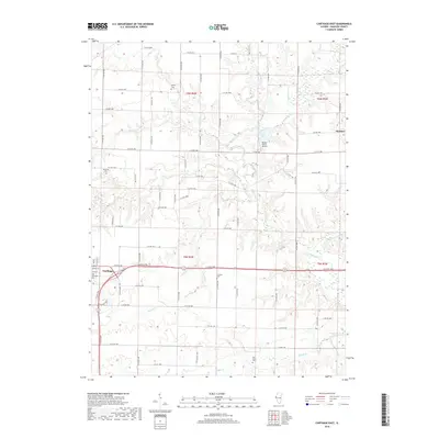
2018 Map of Carthage East
USGS Topo · Published 2018About this map
The agricultural heart of Hancock County is centered around Carthage, where the township grid meets the meandering drainage of the La Moine River and its numerous tributaries. This survey captures a landscape of long-established family farms and rural burying grounds, including McKay Cem, Woodring Cem, and Franklin Cem. The eastern edge of the seat at Carthage shows the proximity of the Old Carthage Cem to the town's edge, while the small settlement of Webster sits on the eastern boundary of the quadrangle. Regional aviation is represented by the Brooks Ranch Airport, located near Linda Lake. The terrain is defined by an intricate network of waterways such as Prairie Cr, Middle Cr, and Long Cr, which break the flat prairie into a series of rolling divides that dictate the placement of local roads and farmsteads.
Find a feature on this map
68 named features on this map. Tap any name to fly to it.
Don’t see what you’re looking for? This feature index may not catch every label — zoom into the map to look around manually.
Map Details
Editions of this 2018 Carthage East Map
This is the sole edition of this map. No revisions or reprints were ever made.
Other maps of this area

1913 · Colchester
USGS Topo · 1:62,500

1918 · La Harpe
USGS Topo · 1:62,500

1932 · Lomax
USGS Topo · 1:62,500

1933 · Carthage
USGS Topo · 1:62,500

1937 · Carthage
USGS Topo · 1:62,500

1937 · Lomax
USGS Topo · 1:62,500

1958 · Burlington
USGS Topo · 1:250,000

1961 · Burlington
USGS Topo · 1:250,000

1963 · Burlington
USGS Topo · 1:250,000
1964 · Colusa
USGS Topo · 1:24,000