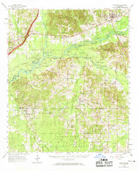
1961 Map of Carthage
USGS Topo · Published 1969About this map
Carthage serves as the central hub in this Mississippi landscape, situated at the junction of critical regional waterways and early transit routes. The Pearl River snakes through the center of the sheet, surrounded by an intricate network of oxbows and named sloughs such as Watson Slough and Duck Pond Slough. To the north, the Yockanookany River and Redwater Creek define the drainage of the Government Hills, while the southern reaches transition into the protected timberlands of the Bienville National Forest.
Find a feature on this map
113 named features on this map. Tap any name to fly to it.
Don’t see what you’re looking for? This feature index may not catch every label — zoom into the map to look around manually.
Map Details
Editions of this 1961 Carthage Map
3 editions found

Other maps of this area

1921 · Forest
USGS Topo · 1:48,000

1922 · Forest
USGS Topo · 1:62,500

1922 · Morton
USGS Topo · 1:48,000

1922 · Pelahatchee
USGS Topo · 1:48,000

1924 · Pelahatchee
USGS Topo · 1:62,500

1924 · Morton
USGS Topo · 1:62,500

1950 · Forest
USGS Topo · 1:62,500

1950 · Pelahatchie
USGS Topo · 1:62,500

1951 · Morton
USGS Topo · 1:62,500

1952 · Pelahatchie
USGS Topo · 1:62,500