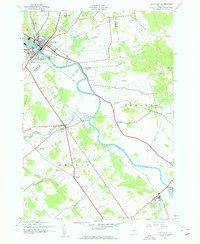
1943 Map of Carthage
USGS Topo · Published 1960About this map
The Black River defines the industrial and geographic heart of this mid-century survey, winding between Carthage and West Carthage as they were during the Second World War. The region's dependence on the New York Central railroad is evident, with the line tracking the river valley through smaller hubs like Deer River and Castorland. This landscape is one of organized rural districts, characterized by a series of numbered local schoolhouses, such as School No 13 and School No 5, which reflect the localized educational structure of the era.
Find a feature on this map
37 named features on this map. Tap any name to fly to it.
Don’t see what you’re looking for? This feature index may not catch every label — zoom into the map to look around manually.
Map Details
Editions of this 1943 Carthage Map
4 editions found

Other maps of this area

1902 · Carthage
USGS Topo · 1:62,500

1904 · Carthage
USGS Topo · 1:62,500

1911 · Antwerp
USGS Topo · 1:62,500

1911 · Lowville
USGS Topo · 1:62,500

1913 · Lowville
USGS Topo · 1:62,500

1913 · Lake Bonaparte
USGS Topo · 1:62,500

1916 · Lake Bonaparte
USGS Topo · 1:62,500

1942 · Copenhagen
USGS Topo · 1:24,000

1943 · Copenhagen
USGS Topo · 1:31,680
1943 · New Boston
USGS Topo · 1:31,680