
1958 Map of Carthage
USGS Topo · Published 1960About this map
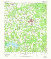
Carthage serves as the focal point of this Panola County landscape, showing the city's mid-century expansion including Panola Jr College and the local Radio Station (KGAS). To the south, the recently completed Lake Murvaul dominates the terrain, with numerous family-named points like Ritter Pt and Dudley Williams Pt jutting into the new reservoir. The area is dense with rural community markers, particularly country churches like Bethlehem Ch and Antioch Ch, alongside small settlements such as Beckville and Gary. Transportation and industry are well-defined by the At & Sf Rr and a network of pipelines and gas wells, reflecting the region's energy-based economy. The northern reaches follow the winding Sabine River and its bottomlands, including Horseshoe Lake and Fish Lake.
Find a feature on this map
69 named features on this map. Tap any name to fly to it.
Don’t see what you’re looking for? This feature index may not catch every label — zoom into the map to look around manually.
Map Details
Editions of this 1958 Carthage Map
2 editions found
Other maps of this area

1943 · Waskom
USGS Topo · 1:62,500

1945 · Waskom
USGS Topo · 1:62,500

1945 · Socagee Bayou
USGS Topo · 1:62,500

1953 · Palestine
USGS Topo · 1:250,000

1956 · Tyler
USGS Topo · 1:250,000

1956 · Deadwood
USGS Topo · 1:62,500

1957 · Palestine
USGS Topo · 1:250,000

1958 · Center
USGS Topo · 1:62,500

1958 · Timpson
USGS Topo · 1:62,500

1958 · Darco
USGS Topo · 1:62,500