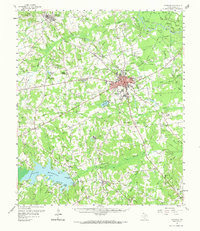
1958 Map of Carthage
USGS Topo · Published 1973About this map
The timbered hills and bayous of East Texas dominate this 1950s survey, centered on the growing county seat of Carthage. This era captures the town at a pivotal moment of expansion, featuring the campus of Panola Jr College and the local Radio Station (KGAS). To the southwest, the newly formed Lake Murvaul reshapes the landscape, submerging the former valley of Murvaul Bayou and creating new landmarks like Dudley Williams Pt and Long Point.
Find a feature on this map
113 named features on this map. Tap any name to fly to it.
Don’t see what you’re looking for? This feature index may not catch every label — zoom into the map to look around manually.
Map Details
Editions of this 1958 Carthage Map
2 editions found

Other maps of this area

1943 · Waskom
USGS Topo · 1:62,500

1945 · Waskom
USGS Topo · 1:62,500

1945 · Socagee Bayou
USGS Topo · 1:62,500

1953 · Palestine
USGS Topo · 1:250,000

1956 · Tyler
USGS Topo · 1:250,000

1956 · Deadwood
USGS Topo · 1:62,500

1957 · Palestine
USGS Topo · 1:250,000

1958 · Center
USGS Topo · 1:62,500

1958 · Timpson
USGS Topo · 1:62,500

1958 · Darco
USGS Topo · 1:62,500