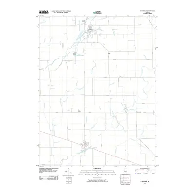
2010 Map of Carthage
USGS Topo · Published 2010About this map
The Big Blue River and Little Blue River dominate this portion of Rush County, carving paths through a landscape defined by its agricultural grid and scattered crossroads. The settlement of Carthage serves as a primary hub in the north, situated near the confluence of several small tributaries like Carthage Creek and Ripley Run. To the south, Arlington anchors the lower portion of the map along a primary road corridor.
Find a feature on this map
79 named features on this map. Tap any name to fly to it.
Don’t see what you’re looking for? This feature index may not catch every label — zoom into the map to look around manually.
Map Details
Editions of this 2010 Carthage Map
This is the sole edition of this map. No revisions or reprints were ever made.
Other maps of this area

1950 · Dunreith
USGS Topo · 1:24,000

1953 · Cincinnati
USGS Topo · 1:250,000

1956 · Cleveland
USGS Topo · 1:24,000

1956 · Morristown
USGS Topo · 1:24,000

1956 · Rays Crossing
USGS Topo · 1:24,000

1957 · Cincinnati
USGS Topo · 1:250,000

1959 · Rushville
USGS Topo · 1:24,000

1959 · Mays
USGS Topo · 1:24,000
1960 · Manilla
USGS Topo · 1:24,000
1960 · Carthage
USGS Topo · 1:24,000