
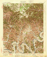
1932 Map of Carthage
USGS Topo · Published 1932About this map
The Cumberland River carves a dramatic series of loops through North Central Tennessee, defining the life and landscape of Smith, Macon, and Jackson Counties in the early 1930s. The county seat of Carthage sits at the river's southern bend, where industry and transportation converge. Life in the surrounding uplands is recorded through a dense network of rural infrastructure, including many schools such as Macey Sch and Franklin Sch, alongside centers of worship like Hickory Grove Ch and Parthenia Chapel.
Find a feature on this map
116 named features on this map. Tap any name to fly to it.
Don’t see what you’re looking for? This feature index may not catch every label — zoom into the map to look around manually.
Map Details
Editions of this 1932 Carthage Map
3 editions found
Other maps of this area

1925 · Gainesboro
USGS Topo · 1:62,500

1928 · Gordonsville
USGS Topo · 1:62,500

1929 · Gainesboro
USGS Topo · 1:62,500

1929 · Tompkinsville
USGS Topo · 1:62,500

1931 · Lafayette
USGS Topo · 1:62,500

1931 · Red Boiling Springs
USGS Topo · 1:62,500

1942 · Statesville
USGS Topo · 1:100,000

1943 · Cookeville
USGS Topo · 1:100,000

1944 · Cookeville
USGS Topo · 1:100,000

1955 · Baxter
USGS Topo · 1:24,000