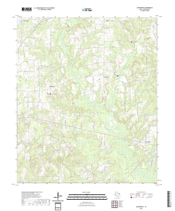
2022 Map of Cartwright
USGS Topo · Published 2022About this map
Big Sandy Creek and its many winding tributaries, including Burleson Br and Jarred Br, define this rural Wood County landscape. Small crossroads communities and family-named settlements like Oak Grove and East Point are scattered throughout the terrain, often centered around local landmarks such as Ebenezer Cemetery and Stout Cemetery. The map reveals a dense network of county roads and farm-to-market routes like FM 14 and FM 312 that connect these residential pockets. Water features are a primary characteristic of the area, ranging from the larger Midway Lake in the northwest corner near Cartwright to more secluded spots like Crones Pond and Round Lake. The settlement pattern of Little Hope in the southeast further illustrates the dispersed, community-focused development typical of this region's history.
Find a feature on this map
96 named features on this map. Tap any name to fly to it.
Don’t see what you’re looking for? This feature index may not catch every label — zoom into the map to look around manually.
Map Details
Editions of this 2022 Cartwright Map
This is the sole edition of this map. No revisions or reprints were ever made.
Other maps of this area

1956 · Tyler
USGS Topo · 1:250,000

1960 · Shady Grove
USGS Topo · 1:24,000

1960 · Hainesville
USGS Topo · 1:24,000

1960 · Winnsboro
USGS Topo · 1:24,000

1960 · Mineola
USGS Topo · 1:24,000

1960 · Cartwright
USGS Topo · 1:24,000

1960 · Newsome
USGS Topo · 1:24,000

1960 · Rhonesboro
USGS Topo · 1:24,000

1960 · Pleasant Grove
USGS Topo · 1:24,000

1960 · Quitman
USGS Topo · 1:24,000