
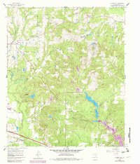
1960 Map of Hainesville
USGS Topo · Published 1962About this map
The settlement of Hainesville and the surrounding Wood County landscape are defined by a dense network of watercourses and early rural infrastructure during the early 1960s. The area is heavily intersected by the Texas and Pacific railroad and a significant Pipeline corridor, reflecting the region's industrial utility. Notable genealogical sites are scattered throughout the hills, including the Mt Pisgah Cem and Maxwell Cem, alongside local gathering points like Macedonia Ch and the Salesmanship Boys Club. The hydraulic history of the area is visible in the numerous branches and ponds, such as Haines Lake, Puckett Lake, and the specific mention of the Doble Lake Spillway. This map captures a moment before modern development, where small communities like Pine Mills and Fouke maintained their own identities with essential facilities like the Pine Mills Sch still documented on the landscape.
Find a feature on this map
46 named features on this map. Tap any name to fly to it.
Don’t see what you’re looking for? This feature index may not catch every label — zoom into the map to look around manually.
Map Details
Editions of this 1960 Hainesville Map
2 editions found
Other maps of this area

1956 · Tyler
USGS Topo · 1:250,000

1960 · Shady Grove
USGS Topo · 1:24,000

1960 · Hawkins
USGS Topo · 1:24,000

1960 · Lindale
USGS Topo · 1:24,000

1960 · Mineola
USGS Topo · 1:24,000

1960 · Cartwright
USGS Topo · 1:24,000

1960 · Rhonesboro
USGS Topo · 1:24,000

1960 · Crow
USGS Topo · 1:24,000

1960 · Quitman
USGS Topo · 1:24,000

1984 · Tyler
USGS Topo · 1:250,000