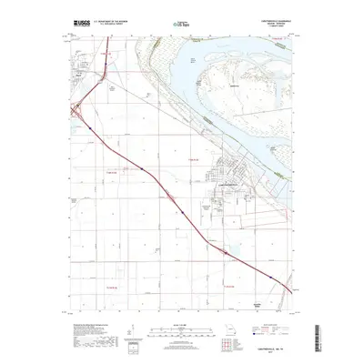
2017 Map of Caruthersville
USGS Topo · Published 2017About this map
Caruthersville and the neighboring town of Hayti serve as the anchors for this Missouri Bootheel landscape along the winding Mississippi River. The river's influence is evident in the complex alluvial features like Little Prairie Bend, Island Number Fifteen, and Blaker Towhead, which define the shifting border with Tennessee. This area is a critical junction for regional travel, where the intersection of Interstate 55 and U.S. Route 412 meets local infrastructure like the Mid Continent Airport and Caruthersville Memorial Airport.
Find a feature on this map
111 named features on this map. Tap any name to fly to it.
Don’t see what you’re looking for? This feature index may not catch every label — zoom into the map to look around manually.
Map Details
Editions of this 2017 Caruthersville Map
This is the sole edition of this map. No revisions or reprints were ever made.
Other maps of this area

1939 · Portageville
USGS Topo · 1:62,500

1939 · Caruthersville
USGS Topo · 1:62,500

1940 · Pascola
USGS Topo · 1:62,500

1940 · Hayti
USGS Topo · 1:62,500

1951 · Caruthersville
USGS Topo · 1:62,500

1955 · Pascola
USGS Topo · 1:62,500

1955 · Hayti
USGS Topo · 1:62,500

1955 · Portageville
USGS Topo · 1:62,500

1956 · Dyersburg
USGS Topo · 1:250,000

1957 · Caruthersville
USGS Topo · 1:62,500