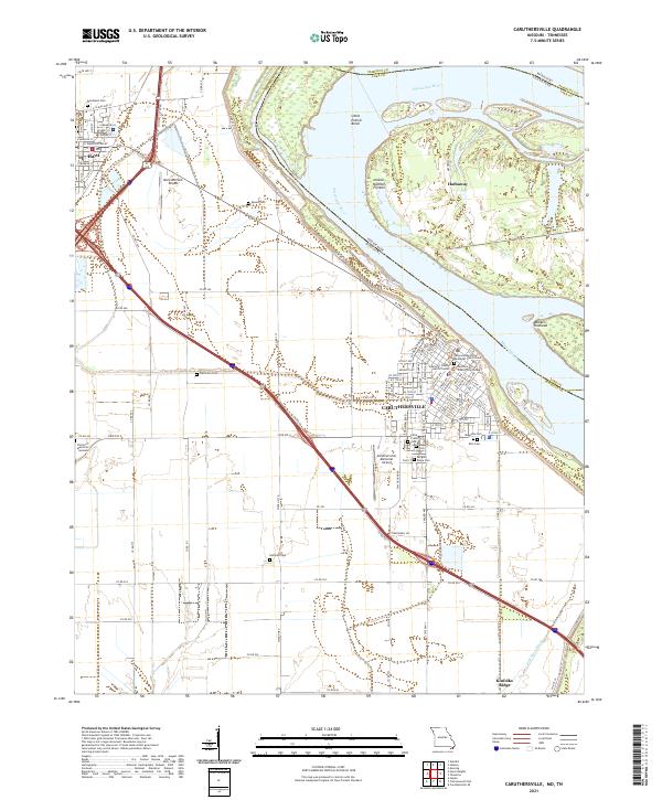
2021 Map of Caruthersville
USGS Topo · Published 2021About this map
Caruthersville sits prominently against a dramatic curve of the Mississippi River known as Little Prairie Bend, serving as a critical hub in the Missouri Bootheel. The map reveals a landscape defined by its relationship to the water and its agricultural roots, with the city grid of Caruthersville showing institutional anchors like the Pemiscot County Courthouse and Pemiscot County Justice Center. To the northwest, the town of Hayti is a secondary center, connected by a network of rural routes and the Mo State Outer Rd. Numerous family-named burial sites, including Speer's Cem, Patterson Cem, and Huffman Cem, are scattered across the surrounding flatlands, providing essential data points for local genealogy. The presence of both the Mid Continent Airport and Caruthersville Memorial Airport underscores the region's importance as a regional transportation nexus.
Find a feature on this map
115 named features on this map. Tap any name to fly to it.
Don’t see what you’re looking for? This feature index may not catch every label — zoom into the map to look around manually.
Map Details
Editions of this 2021 Caruthersville Map
This is the sole edition of this map. No revisions or reprints were ever made.
Other maps of this area

1939 · Portageville
USGS Topo · 1:62,500

1939 · Caruthersville
USGS Topo · 1:62,500

1940 · Pascola
USGS Topo · 1:62,500

1940 · Hayti
USGS Topo · 1:62,500

1951 · Caruthersville
USGS Topo · 1:62,500

1955 · Pascola
USGS Topo · 1:62,500

1955 · Hayti
USGS Topo · 1:62,500

1955 · Portageville
USGS Topo · 1:62,500

1956 · Dyersburg
USGS Topo · 1:250,000

1957 · Caruthersville
USGS Topo · 1:62,500