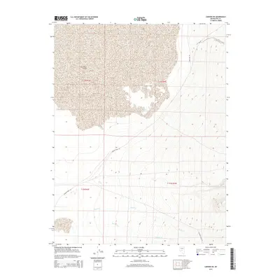
2014 Map of Carvers NE
USGS Topo · Published 2014About this map
Big Smoky Valley dominates the western portion of this landscape, where the alluvial fan meets the valley floor in Nye County. The terrain transitions from the high, steep slopes of the eastern mountains down toward the desert basin. Essential water sources for this arid environment are marked by Big Blue Spring and the drainage courses of Moores Cr and Anderson Cr, which cut westward across the bajada toward the valley bottom.
Find a feature on this map
11 named features on this map. Tap any name to fly to it.
Don’t see what you’re looking for? This feature index may not catch every label — zoom into the map to look around manually.
Map Details
Editions of this 2014 Carvers NE Map
This is the sole edition of this map. No revisions or reprints were ever made.
Other maps of this area

1907 · Tonopah
USGS Topo · 1:250,000

1908 · Tonopah
USGS Topo · 1:250,000

1926 · Roberts Mountains
USGS Topo · 1:250,000

1929 · Roberts Mountains
USGS Topo · 1:250,000

1955 · Millett
USGS Topo · 1:250,000

1956 · Millett Ranch
USGS Topo · 1:62,500

1956 · Tonopah
USGS Topo · 1:250,000

1959 · Tonopah
USGS Topo · 1:250,000

1959 · Millett
USGS Topo · 1:250,000

1960 · Wildcat Peak
USGS Topo · 1:62,500