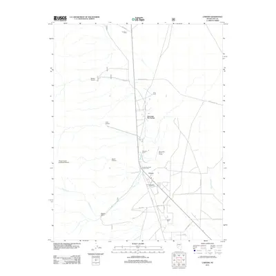
2011 Map of Carvers
USGS Topo · Published 2011About this map
Darroughs Hot Springs serves as a prominent landmark in this central Nevada landscape, where the flat valley floor meets the rising peaks of the Toiyabe Range. The settlement of Carvers acts as a local hub, supported by the Smoky Valley Forest Service Facility and the nearby Carvers Roadside Rest Area. This area is defined by a series of working landscapes and family-named properties, including Twin River Ranch, Bergs Ranch, and Wineglass Ranch, the latter of which features the Wine Glass Ranch Airport. To the west, the terrain becomes dramatically more complex as the alluvial fans give way to deep incisions like Belcher Canyon, Devils Canyon, and Niagara Cañon, all leading toward the high point at Toiyabe Dome Southeast Summit.
Find a feature on this map
25 named features on this map. Tap any name to fly to it.
Don’t see what you’re looking for? This feature index may not catch every label — zoom into the map to look around manually.
Map Details
Editions of this 2011 Carvers Map
This is the sole edition of this map. No revisions or reprints were ever made.
Other maps of this area

1907 · Tonopah
USGS Topo · 1:250,000

1908 · Tonopah
USGS Topo · 1:250,000

1956 · Tonopah
USGS Topo · 1:250,000

1959 · Tonopah
USGS Topo · 1:250,000

1962 · Tonopah
USGS Topo · 1:250,000

1971 · Carvers NW
USGS Topo · 1:24,000

1971 · Carvers
USGS Topo · 1:24,000

1971 · Pablo Canyon Ranch
USGS Topo · 1:24,000
1971 · Carvers NE
USGS Topo · 1:24,000
1971 · Carvers SE
USGS Topo · 1:24,000