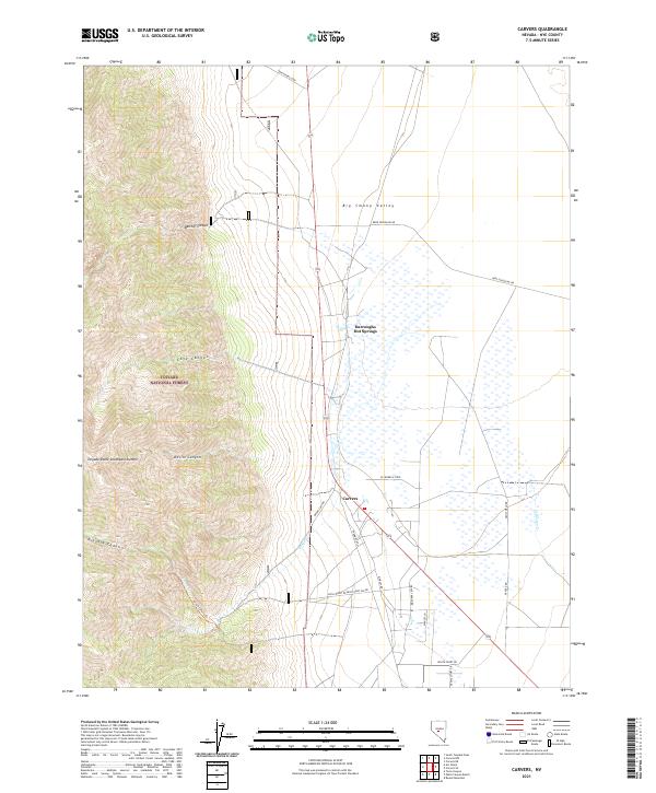
2021 Map of Carvers
USGS Topo · Published 2021About this map
Darroughs Hot Springs and the settlement of Carvers anchor this central Nevada landscape where the floor of the Big Smoky Valley meets the high elevations of the Toiyabe National Forest. The transition from the valley floor to the peaks is marked by a series of steep drainages, including Belcher Canyon, Cove Canyon, and Devils Canyon, which define the western half of the quadrangle. High points like the Toiyabe Dome Southeast Summit tower over the valley, offering a rugged contrast to the more developed eastern sections.
Find a feature on this map
39 named features on this map. Tap any name to fly to it.
Don’t see what you’re looking for? This feature index may not catch every label — zoom into the map to look around manually.
Map Details
Editions of this 2021 Carvers Map
This is the sole edition of this map. No revisions or reprints were ever made.
Other maps of this area

1907 · Tonopah
USGS Topo · 1:250,000

1908 · Tonopah
USGS Topo · 1:250,000

1956 · Tonopah
USGS Topo · 1:250,000

1959 · Tonopah
USGS Topo · 1:250,000

1962 · Tonopah
USGS Topo · 1:250,000

1971 · Carvers NW
USGS Topo · 1:24,000

1971 · Carvers
USGS Topo · 1:24,000

1971 · Pablo Canyon Ranch
USGS Topo · 1:24,000
1971 · Carvers NE
USGS Topo · 1:24,000
1971 · Carvers SE
USGS Topo · 1:24,000