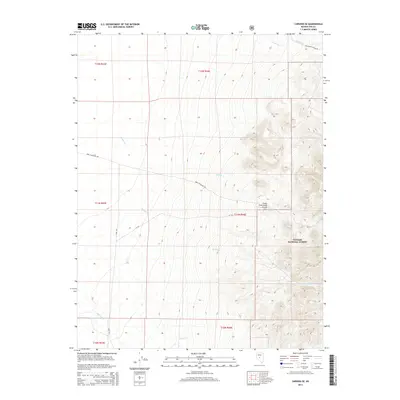
2014 Map of Carvers SE
USGS Topo · Published 2014About this map
Toiyabe National Forest dominates this section of the Toquima Range, where high-elevation drainage systems define the arid landscape. The map reveals a network of seasonal watercourses including Barker Cr, Willow Cr, and Jefferson Cr that descend from the steep eastern slopes. A notable point of human activity is the Barker Creek Ranch Airstrip, which serves as a remote outpost in this difficult terrain. Local travel and access are facilitated by utilitarian routes such as Berg Fenceline Rd and the McConnell Access Rd, tracing the boundaries of public and private land. This survey illustrates the rugged intersection of conservation land and ranching infrastructure, typical of the central Nevada wilderness in the early twenty-first century.
Find a feature on this map
18 named features on this map. Tap any name to fly to it.
Don’t see what you’re looking for? This feature index may not catch every label — zoom into the map to look around manually.
Map Details
Editions of this 2014 Carvers SE Map
This is the sole edition of this map. No revisions or reprints were ever made.
Other maps of this area

1907 · Tonopah
USGS Topo · 1:250,000

1908 · Tonopah
USGS Topo · 1:250,000

1956 · Tonopah
USGS Topo · 1:250,000

1959 · Tonopah
USGS Topo · 1:250,000

1962 · Tonopah
USGS Topo · 1:250,000

1971 · Carvers NW
USGS Topo · 1:24,000

1971 · Carvers
USGS Topo · 1:24,000
1971 · Jet Spring
USGS Topo · 1:24,000

1971 · Pablo Canyon Ranch
USGS Topo · 1:24,000
1971 · Carvers NE
USGS Topo · 1:24,000