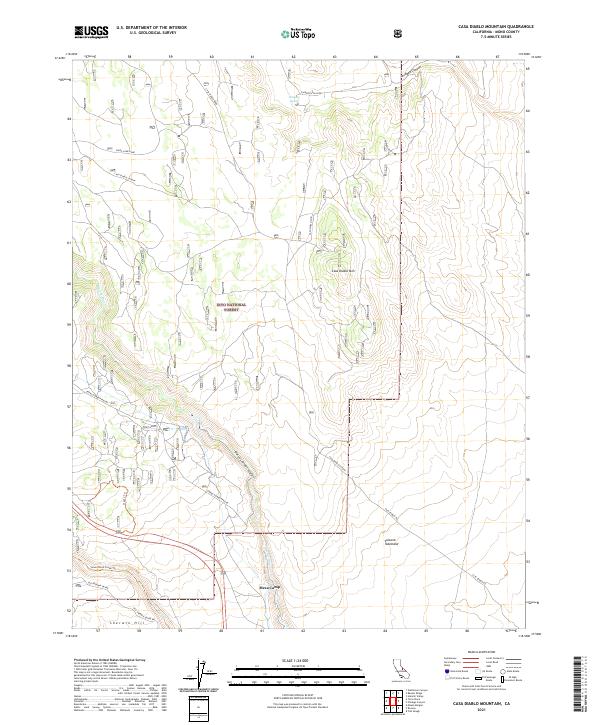
2021 Map of Casa Diablo Mountain
USGS Topo · Published 2021About this map
Casa Diablo Mountain stands as the central topographic feature of this high-altitude landscape, part of the extensive Inyo National Forest. The map documents a rugged transition between the Volcanic Tableland and the dramatic incision of the Owens River Gorge. Historically significant transportation routes are etched into the terrain, including the Old Sherwin Grade and Casa Diablo Road, which provided vital passage through this challenging portion of Mono County. The presence of Mesa Camp and scattered water sources like Antelope Spring suggest the area's long-standing utility for travelers and seasonal inhabitants. Modern infrastructure is represented by the Owens Gorge Pipeline, tracing the path of the Owens River as it flows south toward the Sherwin Hill vicinity. For researchers, the map preserves the exact alignment of historical 4WD tracks and trails, such as the Lower Rock Creek Trl, alongside modern land management boundaries.
Find a feature on this map
25 named features on this map. Tap any name to fly to it.
Don’t see what you’re looking for? This feature index may not catch every label — zoom into the map to look around manually.
Map Details
Editions of this 2021 Casa Diablo Mountain Map
This is the sole edition of this map. No revisions or reprints were ever made.
Other maps of this area

1912 · Mt. Goddard
USGS Topo · 1:125,000

1913 · Bishop
USGS Topo · 1:125,000

1914 · Mt. Morrison
USGS Topo · 1:125,000

1917 · White Mountain
USGS Topo · 1:125,000

1947 · Mariposa
USGS Topo · 1:250,000

1948 · Mariposa
USGS Topo · 1:250,000

1949 · Mt. Tom
USGS Topo · 1:62,500

1949 · Bishop
USGS Topo · 1:62,500

1951 · Mt. Tom
USGS Topo · 1:62,500

1951 · Bishop
USGS Topo · 1:62,500