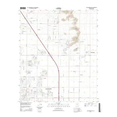
2014 Map of Casa Grande East
USGS Topo · Published 2014About this map
Casa Grande and Coolidge anchor this desert landscape, where suburban growth and agricultural divisions meet the rising slopes of the Sacaton Mountains. The terrain is defined by the prominent height of Signal Peak and the nearby Black Butte, contrasting with the low-lying channel of the N Br Santa Cruz Wash that traverses the basin floor. Educational development is represented by the Central Arizona Coll campus, situated east of the mountains. A dense grid of residential streets, including E Avenida Luna and W Belmont Dr, illustrates the residential expansion of the early 21st century. This map traces the transition from high desert wilderness into the structured irrigation and township divisions of t5s r6e and t5s r7e.
Find a feature on this map
111 named features on this map. Tap any name to fly to it.
Don’t see what you’re looking for? This feature index may not catch every label — zoom into the map to look around manually.
Map Details
Editions of this 2014 Casa Grande East Map
This is the sole edition of this map. No revisions or reprints were ever made.
Other maps of this area

1907 · Sacaton
USGS Topo · 1:62,500

1914 · Gila Butte
USGS Topo · 1:62,500

1917 · Gila Butte
USGS Topo · 1:62,500

1922 · Casa Grande
USGS Topo · 1:62,500

1922 · Signal Peak
USGS Topo · 1:62,500

1924 · Signal Peak
USGS Topo · 1:62,500

1924 · Casa Grande
USGS Topo · 1:62,500

1952 · Gila Butte SE
USGS Topo · 1:24,000

1952 · Gila Butte
USGS Topo · 1:62,500

1954 · Mesa
USGS Topo · 1:250,000