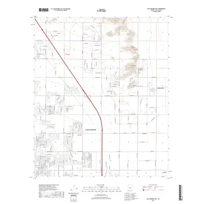
2018 Map of Casa Grande East
USGS Topo · Published 2018About this map
Sacaton Mountains and the prominent Signal Peak anchor the northeast corner of this Pinal County landscape, rising sharply above the desert floor. The map documents the eastern expansion of Casa Grande and its adjacency to the neighboring communities of Coolidge and Eloy. The terrain is defined by a rigid grid of agricultural and residential roads, such as W Woodruff Rd and W Randolph Rd, which intersect the natural drainage of the N Br Santa Cruz Wash.
Find a feature on this map
60 named features on this map. Tap any name to fly to it.
Don’t see what you’re looking for? This feature index may not catch every label — zoom into the map to look around manually.
Map Details
Editions of this 2018 Casa Grande East Map
This is the sole edition of this map. No revisions or reprints were ever made.
Other maps of this area

1907 · Sacaton
USGS Topo · 1:62,500

1914 · Gila Butte
USGS Topo · 1:62,500

1917 · Gila Butte
USGS Topo · 1:62,500

1922 · Casa Grande
USGS Topo · 1:62,500

1922 · Signal Peak
USGS Topo · 1:62,500

1924 · Signal Peak
USGS Topo · 1:62,500

1924 · Casa Grande
USGS Topo · 1:62,500

1952 · Gila Butte SE
USGS Topo · 1:24,000

1952 · Gila Butte
USGS Topo · 1:62,500

1954 · Mesa
USGS Topo · 1:250,000