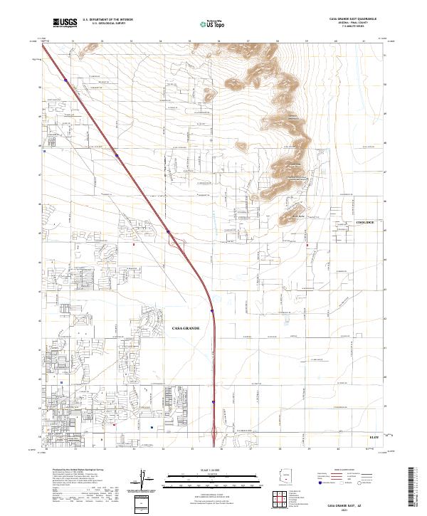
2021 Map of Casa Grande East
USGS Topo · Published 2021About this map
Casa Grande serves as the focal point of this Pinal County landscape, showing a dense residential grid transitioning into the desert lowlands. The modern infrastructure of the early 2020s is evident in the sprawling network of roads such as W Val Vista Blvd and E McCartney Rd that connect the growing outskirts of Coolidge and Eloy. The terrain is dominated by the Sacaton Mountains, where Signal Peak rises above the valley floor. This survey documents the educational footprint of the region, specifically the Central Arizona College Signal Peak Campus and the Central Arizona College Casa Grande Center, illustrating how suburban development has integrated with traditional desert landmarks like Black Butte and the ephemeral drainage of the N Br Santa Cruz Wash.
Find a feature on this map
71 named features on this map. Tap any name to fly to it.
Don’t see what you’re looking for? This feature index may not catch every label — zoom into the map to look around manually.
Map Details
Editions of this 2021 Casa Grande East Map
This is the sole edition of this map. No revisions or reprints were ever made.
Other maps of this area

1907 · Sacaton
USGS Topo · 1:62,500

1914 · Gila Butte
USGS Topo · 1:62,500

1917 · Gila Butte
USGS Topo · 1:62,500

1922 · Casa Grande
USGS Topo · 1:62,500

1922 · Signal Peak
USGS Topo · 1:62,500

1924 · Signal Peak
USGS Topo · 1:62,500

1924 · Casa Grande
USGS Topo · 1:62,500

1952 · Gila Butte SE
USGS Topo · 1:24,000

1952 · Gila Butte
USGS Topo · 1:62,500

1954 · Mesa
USGS Topo · 1:250,000