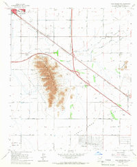
1965 Map of Casa Grande Mts
USGS Topo · Published 1966About this map
Casa Grande and the smaller settlements of Arizola and Eloy anchor this mid-1960s landscape, where desert terrain meets an expanding agricultural and industrial footprint. The Casa Grande Mts dominate the central portion of the map, notably featuring the Casa Grande Military Res and the local recreational hub at Casa Grande Country Club. South of the peaks, the vast Santa Cruz Flats stretch toward Arizona City, illustrating the region's reliance on water management through the Casa Grande Canal and Florence Canal systems.
Find a feature on this map
30 named features on this map. Tap any name to fly to it.
Don’t see what you’re looking for? This feature index may not catch every label — zoom into the map to look around manually.
Map Details
Editions of this 1965 Casa Grande Mts Map
3 editions found
Other maps of this area

1922 · Casa Grande
USGS Topo · 1:62,500

1922 · Signal Peak
USGS Topo · 1:62,500

1924 · Signal Peak
USGS Topo · 1:62,500

1924 · Casa Grande
USGS Topo · 1:62,500

1942 · Silver Reef Mountains
USGS Topo · 1:62,500

1947 · Eloy
USGS Topo · 1:62,500

1948 · Eloy
USGS Topo · 1:62,500

1956 · Tucson
USGS Topo · 1:250,000

1958 · Tucson
USGS Topo · 1:250,000

1959 · Tucson
USGS Topo · 1:250,000