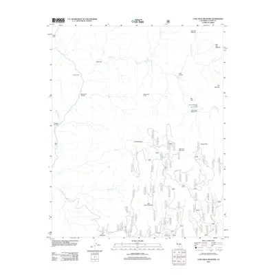
2012 Map of Casa Vieja Meadows
USGS Topo · Published 2012About this map
Casa Vieja Meadows and its surrounding high-elevation basins define this 2012 survey of Tulare County. The map details a landscape managed for both recreation and preservation, centered on the Casa Vieja Meadows Forest Service Facility. This region is characterized by a series of distinct clearings such as Bog Hole Meadow, Beer Keg Meadow, and Lion Meadows, connected by an intricate network of Forest Service routes including Forest Rte 20S20. The Kern River flows through the western portion of the quadrangle, joined by tributaries like Ninemile Cr and Soda Cr. High points such as Blackrock Mountain and Doc Peak watch over a terrain dotted with seasonal outposts like Painter Camp. The presence of Jordan Hot Springs suggests the geothermal activity inherent to this part of the Sierra Nevada.
Find a feature on this map
98 named features on this map. Tap any name to fly to it.
Don’t see what you’re looking for? This feature index may not catch every label — zoom into the map to look around manually.
Map Details
Editions of this 2012 Casa Vieja Meadows Map
This is the sole edition of this map. No revisions or reprints were ever made.
Other maps of this area

1905 · Olancha
USGS Topo · 1:125,000

1907 · Olancha
USGS Topo · 1:125,000

1948 · Fresno
USGS Topo · 1:250,000

1955 · Fresno
USGS Topo · 1:250,000

1956 · Fresno
USGS Topo · 1:250,000

1956 · Hockett Peak
USGS Topo · 1:62,500
1956 · Monache Mtn
USGS Topo · 1:62,500

1956 · Olancha
USGS Topo · 1:62,500
1956 · Kern Peak
USGS Topo · 1:62,500

1958 · Fresno
USGS Topo · 1:250,000