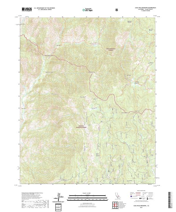
2021 Map of Casa Vieja Meadows
USGS Topo · Published 2021About this map
Jordan Hot Springs and Soda Flat mark key human landing points in this high-elevation landscape where the Inyo National Forest meets the Sequoia National Forest. The topography is dominated by the deeply carved corridor of the Kern Wild and Scenic River, which separates the high ridges of Blackrock Mtn and Manzanita Knob from the eastern plateaus. The map details an intricate network of specialized meadows, including Casa Vieja Meadows, Little Horse Meadows, and the colorfully named Beer Keg Meadow. These clearings suggest a history of seasonal use and grazing, connected by an extensive system of pack trails like the Sidehill Meadow Trl and the Black Rock To Kern River Trl. The presence of Kern Flat along the river highlights the few level areas suitable for camps in an otherwise vertical wilderness.
Find a feature on this map
51 named features on this map. Tap any name to fly to it.
Don’t see what you’re looking for? This feature index may not catch every label — zoom into the map to look around manually.
Map Details
Editions of this 2021 Casa Vieja Meadows Map
This is the sole edition of this map. No revisions or reprints were ever made.
Other maps of this area

1905 · Olancha
USGS Topo · 1:125,000

1907 · Olancha
USGS Topo · 1:125,000

1948 · Fresno
USGS Topo · 1:250,000

1955 · Fresno
USGS Topo · 1:250,000

1956 · Fresno
USGS Topo · 1:250,000

1956 · Hockett Peak
USGS Topo · 1:62,500
1956 · Monache Mtn
USGS Topo · 1:62,500

1956 · Olancha
USGS Topo · 1:62,500
1956 · Kern Peak
USGS Topo · 1:62,500

1958 · Fresno
USGS Topo · 1:250,000