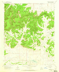
1963 Map of Casamero Lake
USGS Topo · Published 1965About this map
The Continental Divide snake across this high-desert landscape in McKinley County, defining the drainage patterns between the northern mesas and the southern draws. Settlement is sparse, anchored by the Borrego Pass Trading Post near the eastern edge. The map captures a transition from the elevated peaks of Wheat Grass Butte and Red Butte down to the intermittent waters of Casamero Lake and the Casamero Draw. Vital water sources for livestock and travelers are carefully documented, including Many Mexican Spring, Blue Water Spring, and Owl Spring. A pack trail traverses the rugged contours near Wheat Grass Pass, reflecting the traditional routes used to navigate this complex terrain. Notable landmarks like Cream Colored Rock and The Cup provide distinct navigational markers in a region where geography dictates the path of every road and trail.
Find a feature on this map
24 named features on this map. Tap any name to fly to it.
Don’t see what you’re looking for? This feature index may not catch every label — zoom into the map to look around manually.
Map Details
Editions of this 1963 Casamero Lake Map
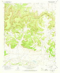
2 editions found
Other maps of this area

1883 · Mt. Taylor
USGS Topo · 1:250,000

1886 · Wingate
USGS Topo · 1:250,000

1886 · Mt. Taylor
USGS Topo · 1:250,000

1892 · Wingate
USGS Topo · 1:250,000

1892 · Mt. Taylor
USGS Topo · 1:250,000

1899 · Mt. Taylor
USGS Topo · 1:250,000

1954 · Gallup
USGS Topo · 1:250,000

1957 · Goat Mountain
USGS Topo · 1:24,000

1958 · Gallup
USGS Topo · 1:250,000

1958 · Albuquerque
USGS Topo · 1:250,000
Featured Places
- Eastern Navajo Agency, NM
- Borrego Pass, NM
- Casamero Lake, Eastern Navajo Agency
- McKinley County, NM
- United States