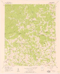
1956 Map of Casar
USGS Topo · Published 1958About this map
Township No 11 and the surrounding borderlands of Cleveland, Burke, Catawba, and Lincoln Counties are defined by a network of rural settlements and country churches in this mid-century survey. The landscape transitions from the higher elevations of Doublehead Mtn and Brushy Knob in the north toward the agricultural communities of Casar, Ramsey, and Toluca. The density of local landmarks like Carpenters Grove Ch and Olive Grove Ch suggests a deeply rooted social geography, where small congregations served as the primary nodes of community life along the watershed of Knob Creek and the South Fork Jacob Fork.
Find a feature on this map
54 named features on this map. Tap any name to fly to it.
Don’t see what you’re looking for? This feature index may not catch every label — zoom into the map to look around manually.
Map Details
Editions of this 1956 Casar Map
2 editions found
Other maps of this area

1895 · Hickory
USGS Topo · 1:125,000

1905 · Morganton
USGS Topo · 1:125,000

1909 · Lincolnton
USGS Topo · 1:62,500

1911 · Lincolnton
USGS Topo · 1:62,500

1950 · Shelby
USGS Topo · 1:62,500

1953 · Charlotte
USGS Topo · 1:250,000

1954 · Charlotte
USGS Topo · 1:250,000

1956 · Valdese
USGS Topo · 1:24,000

1956 · Benn Knob
USGS Topo · 1:24,000

1956 · Casar
USGS Topo · 1:24,000