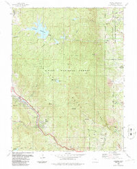
1986 Map of Cascade
USGS Topo · Published 1986About this map
Rampart Range terrain dominates this mid-1980s landscape, illustrating the complex intersection of federal military land, municipal water infrastructure, and mountain recreation. The eastern edge is defined by the United States Air Force Academy, where Academy Drive and a filtration plant sit adjacent to the National Forest Boundary. To the west, the massive Rampart Reservoir features a spillway at 9,000 feet, feeding an intricate system of aqueducts and smaller reservoirs like Palmer Reservoir and Manitou Reservoir.
Find a feature on this map
54 named features on this map. Tap any name to fly to it.
Don’t see what you’re looking for? This feature index may not catch every label — zoom into the map to look around manually.
Map Details
Editions of this 1986 Cascade Map
2 editions found
Other maps of this area

1893 · Platte Canyon
USGS Topo · 1:125,000

1893 · Colorado Springs
USGS Topo · 1:125,000

1894 · Pikes Peak
USGS Topo · 1:125,000

1894 · Castle Rock
USGS Topo · 1:125,000

1901 · Pikes Peak
USGS Topo · 1:125,000

1901 · Pikes Peak
USGS Topo · 1:62,500

1909 · Colorado Springs
USGS Topo · 1:125,000

1913 · Castle Rock
USGS Topo · 1:125,000

1942 · Colorado Springs
USGS Topo · 1:125,000

1948 · Manitou Springs
USGS Topo · 1:24,000