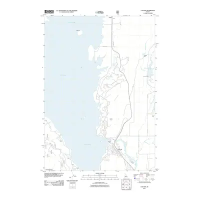
2011 Map of Cascade
USGS Topo · Published 2011About this map
Lake Cascade dominates this Valley County landscape, its western shoreline defined by the prominent peak of Sugarloaf and the peninsula of Crown Point. The town of Cascade sits at the southern end of the reservoir where the Cascade Dam regulates the North Fork Payette River. This 2011 survey reveals a complex network of modern residential development and recreation access roads along the eastern shore, including Mountain Air Dr and Vista Point Loop.
Find a feature on this map
35 named features on this map. Tap any name to fly to it.
Don’t see what you’re looking for? This feature index may not catch every label — zoom into the map to look around manually.
Map Details
Editions of this 2011 Cascade Map
This is the sole edition of this map. No revisions or reprints were ever made.
Other maps of this area

1894 · Squaw Creek
USGS Topo · 1:125,000

1909 · Garden Valley
USGS Topo · 1:125,000

1911 · Meadows
USGS Topo · 1:125,000

1953 · Smiths Ferry
USGS Topo · 1:62,500

1953 · Boiling Springs
USGS Topo · 1:62,500

1954 · Gold Fork
USGS Topo · 1:62,500

1954 · Cascade
USGS Topo · 1:62,500

1955 · Baker
USGS Topo · 1:250,000

1957 · Challis
USGS Topo · 1:250,000

1959 · Baker
USGS Topo · 1:250,000