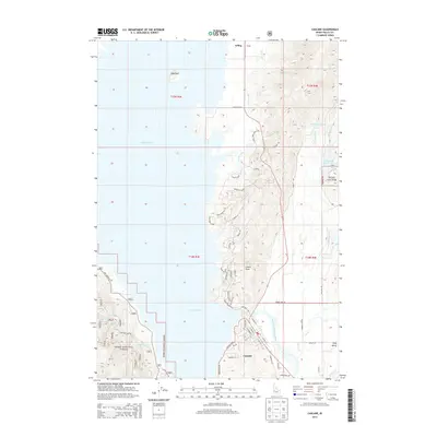
2013 Map of Cascade
USGS Topo · Published 2013About this map
Cascade and the surrounding high-altitude terrain define this landscape at the dawn of the 2010s, where the North Fork Payette River meets the expansive waters of Lake Cascade. The settlement of Arling sits to the north, marking a point along the agricultural and residential corridor of Long Valley. The topography is dominated by distinct landmarks such as Crown Point and Sugarloaf, while water management is evident through the winding path of the Center Canal and the presence of high-country impoundments like Smalley Reservoir and Jemima K Reservoir. These features reflect the complex relationship between recreation and irrigation in central Idaho. The map also highlights the rugged boundaries of the Boise National Forest, showing a network of mountain access roads including Van Wyck Rd and Cabarton Rd that connect the valley floor to the forested uplands.
Find a feature on this map
99 named features on this map. Tap any name to fly to it.
Don’t see what you’re looking for? This feature index may not catch every label — zoom into the map to look around manually.
Map Details
Editions of this 2013 Cascade Map
This is the sole edition of this map. No revisions or reprints were ever made.
Other maps of this area

1894 · Squaw Creek
USGS Topo · 1:125,000

1909 · Garden Valley
USGS Topo · 1:125,000

1911 · Meadows
USGS Topo · 1:125,000

1953 · Smiths Ferry
USGS Topo · 1:62,500

1953 · Boiling Springs
USGS Topo · 1:62,500

1954 · Gold Fork
USGS Topo · 1:62,500

1954 · Cascade
USGS Topo · 1:62,500

1955 · Baker
USGS Topo · 1:250,000

1957 · Challis
USGS Topo · 1:250,000

1959 · Baker
USGS Topo · 1:250,000