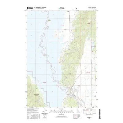
2017 Map of Cascade
USGS Topo · Published 2017About this map
Lake Cascade dominates the western half of this Idaho landscape, where the waters fill the basin of Long Valley alongside the Boise National Forest. The town of Cascade serves as the primary hub, situated along the Payette River Scenic Byway and the banks of the North Fork Payette River. The street grid of the town is detailed down to N School St and N Idaho St, while residential developments like Pine Lakes Ranch Dr extend toward the shoreline.
Find a feature on this map
64 named features on this map. Tap any name to fly to it.
Don’t see what you’re looking for? This feature index may not catch every label — zoom into the map to look around manually.
Map Details
Editions of this 2017 Cascade Map
This is the sole edition of this map. No revisions or reprints were ever made.
Other maps of this area

1894 · Squaw Creek
USGS Topo · 1:125,000

1909 · Garden Valley
USGS Topo · 1:125,000

1911 · Meadows
USGS Topo · 1:125,000

1953 · Smiths Ferry
USGS Topo · 1:62,500

1953 · Boiling Springs
USGS Topo · 1:62,500

1954 · Gold Fork
USGS Topo · 1:62,500

1954 · Cascade
USGS Topo · 1:62,500

1955 · Baker
USGS Topo · 1:250,000

1957 · Challis
USGS Topo · 1:250,000

1959 · Baker
USGS Topo · 1:250,000