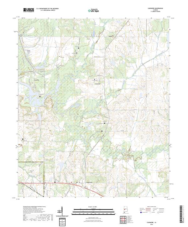
2024 Map of Casemore
USGS Topo · Published 2024About this map
Prairieville and Cedarville anchor this portion of Hale County, where the landscape is defined by the winding course of the Black Warrior River and a dense network of tributaries. The western edge of the map follows the river's path, marked by riverine features like Tindells Bar and the historic site of Drakes Landing Ferry. A notable engineering landmark, Lock Five, sits on the riverbank, indicating the importance of water management for regional navigation.
Find a feature on this map
65 named features on this map. Tap any name to fly to it.
Don’t see what you’re looking for? This feature index may not catch every label — zoom into the map to look around manually.
Map Details
Editions of this 2024 Casemore Map
This is the sole edition of this map. No revisions or reprints were ever made.
Other maps of this area

1946 · Demopolis
USGS Topo · 1:24,000

1947 · Demopolis
USGS Topo · 1:24,000

1947 · Mason Bend
USGS Topo · 1:24,000

1948 · Mason Bend
USGS Topo · 1:24,000

1953 · Montgomery
USGS Topo · 1:250,000

1956 · Montgomery
USGS Topo · 1:250,000

1957 · Montgomery
USGS Topo · 1:250,000

1968 · Uniontown West
USGS Topo · 1:24,000

1968 · Gallion
USGS Topo · 1:24,000

1970 · Old Spring Hill
USGS Topo · 1:24,000