
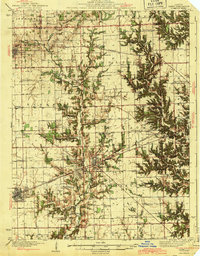
1943 Map of Casey
USGS Topo · Published 1943About this map
Martinsville and Casey anchor this mid-century landscape where agriculture, transportation, and early energy infrastructure converged. The Pennsylvania RR railroad cuts a diagonal line across the terrain, serving the commercial centers and the industrial footprint of the Tank Farm located just northwest of Martinsville. This facility, along with the nearby settlement of Oilfield, points to the region's historical connection to the Illinois oil basin.
Find a feature on this map
77 named features on this map. Tap any name to fly to it.
Don’t see what you’re looking for? This feature index may not catch every label — zoom into the map to look around manually.
Map Details
Editions of this 1943 Casey Map
2 editions found
Other maps of this area

1932 · Marshall
USGS Topo · 1:62,500

1933 · Toledo
USGS Topo · 1:62,500

1936 · Oakland
USGS Topo · 1:48,000

1936 · Casey
USGS Topo · 1:48,000

1937 · Marshall
USGS Topo · 1:62,500

1938 · Toledo
USGS Topo · 1:62,500

1940 · Greenup
USGS Topo · 1:62,500

1942 · Oakland
USGS Topo · 1:62,500

1942 · Casey
USGS Topo · 1:62,500

1943 · Greenup
USGS Topo · 1:62,500