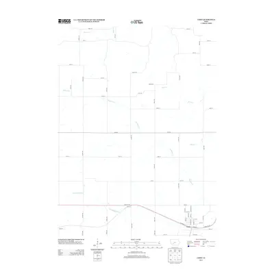
2013 Map of Casey
USGS Topo · Published 2013About this map
Dalmanutha and Casey anchor this landscape in the early 21st century, where the headwaters of the Middle River and S Fork Middle River carve through the agricultural fields of southwestern Iowa. The settlement pattern is defined by a rigorous grid of section-line roads, including Hickory Ave and Koala Ave, punctuated by evocative local names like Jaguar Trl and Lost Trl. Near the southern edge, White Pole Rd follows the historic transportation corridor through the town of Casey, paralleling the modern interstate path. Waterways such as Beaver Cr and S Beaver Cr drain the eastern portion of the quadrangle, illustrating the natural drainage patterns that historically dictated farm placement and rural development. This survey provides a precise look at the modern rural infrastructure and land use, from the residential streets like W Oak St to the remote crossings of Mason Cr.
Find a feature on this map
48 named features on this map. Tap any name to fly to it.
Don’t see what you’re looking for? This feature index may not catch every label — zoom into the map to look around manually.
Map Details
Editions of this 2013 Casey Map
This is the sole edition of this map. No revisions or reprints were ever made.
Other maps of this area

1952 · Panora
USGS Topo · 1:62,500

1954 · Greenfield
USGS Topo · 1:62,500

1954 · Omaha
USGS Topo · 1:250,000

1957 · Omaha
USGS Topo · 1:250,000

1958 · Omaha
USGS Topo · 1:250,000

1971 · Adair South
USGS Topo · 1:24,000

1971 · Canby
USGS Topo · 1:24,000

1971 · North Branch
USGS Topo · 1:24,000

1971 · Casey
USGS Topo · 1:24,000

1971 · Guthrie Center West
USGS Topo · 1:24,000