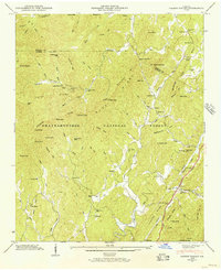
1946 Map of Cashes Valley
USGS Topo · Published 1956About this map
Cashes Valley serves as a central corridor through the northern Georgia mountains, where life in the mid-1940s revolved around a network of small schools and churches like Macedonia Sch and Youngs Chapel. The landscape is divided by the Blue Ridge Divide and the Tennessee Valley Divide, topographic boundaries that dictated the paths of local water like Fightingtown Creek and the Ellijay River. Near the southeast corner, the Louisville and Nashville railroad runs parallel to a Scenic Highway, connecting the small communities of Cherrylog and White Path to the wider region.
Find a feature on this map
89 named features on this map. Tap any name to fly to it.
Don’t see what you’re looking for? This feature index may not catch every label — zoom into the map to look around manually.
Map Details
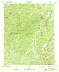
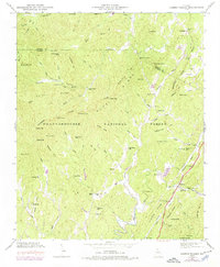
Editions of this 1946 Cashes Valley Map
3 editions found
Other maps of this area

1886 · Dalton
USGS Topo · 1:125,000

1888 · Ellijay
USGS Topo · 1:125,000

1892 · Ellijay
USGS Topo · 1:125,000

1892 · Dalton
USGS Topo · 1:125,000

1897 · Dalton
USGS Topo · 1:125,000

1898 · Ellijay
USGS Topo · 1:125,000

1911 · Ellijay
USGS Topo · 1:125,000

1911 · Cohutta Mtn
USGS Topo · 1:62,500

1913 · Cohutta Mtn.
USGS Topo · 1:62,500

1914 · Talking Rock
USGS Topo · 1:62,500