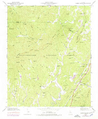
1946 Map of Cashes Valley
USGS Topo · Published 1975About this map
Fightingtown Creek winds through the northern reaches of this territory, where the borders of Fannin Co and Gilmer Co meet along the high ridges. This landscape is defined by the Blue Ridge Divide and the Chattahoochee National Forest, which shelter isolated settlements like Cashes Valley. Local life in the mid-20th century centered on landmarks such as Cashes Valley Ch and its neighboring Cashes Valley Sch, while industrial activity is represented by the presence of Higdon Mill and Jones Mill. To the southeast, the Louisville and Nashville railroad tracks follow the corridor through Cherrylog, providing a vital transportation link through the mountains. The map preserves the locations of family-named sites such as Underwood Cem and Johnson Cem, offering a detailed record of the rural Georgia Highlands before modern development changed the character of these mountain hollows.
Find a feature on this map
90 named features on this map. Tap any name to fly to it.
Don’t see what you’re looking for? This feature index may not catch every label — zoom into the map to look around manually.
Map Details
Editions of this 1946 Cashes Valley Map
3 editions found
Other maps of this area

1886 · Dalton
USGS Topo · 1:125,000

1888 · Ellijay
USGS Topo · 1:125,000

1892 · Ellijay
USGS Topo · 1:125,000

1892 · Dalton
USGS Topo · 1:125,000

1897 · Dalton
USGS Topo · 1:125,000

1898 · Ellijay
USGS Topo · 1:125,000

1911 · Ellijay
USGS Topo · 1:125,000

1911 · Cohutta Mtn
USGS Topo · 1:62,500

1913 · Cohutta Mtn.
USGS Topo · 1:62,500

1914 · Talking Rock
USGS Topo · 1:62,500