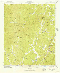
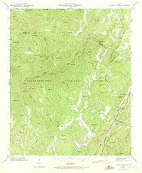
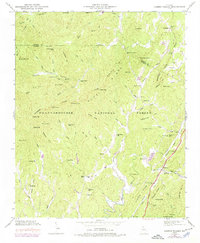
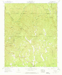
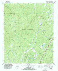
1946 Map of Cashes Valley
USGS Topo · Published 1956This historical map portrays the area of Cashes Valley in 1946, primarily covering Gilmer County as well as portions of Fannin County. Featuring a scale of 1:24000, this map provides a highly detailed snapshot of the terrain, roads, buildings, counties, and historical landmarks in the Cashes Valley region at the time. Published in 1956, it is one of 3 known editions of this map due to revisions or reprints.
Find a feature on this map
89 named features on this map. Tap any name to fly to it.
Don’t see what you’re looking for? This feature index may not catch every label — zoom into the map to look around manually.
Map Details
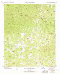
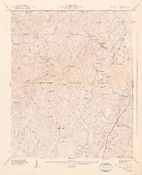
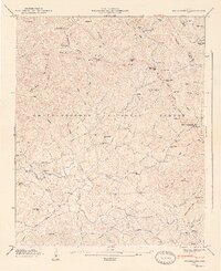
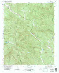
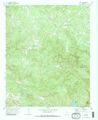
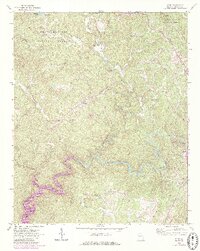
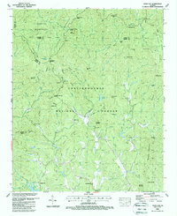
Editions of this 1946 Cashes Valley Map
3 editions found
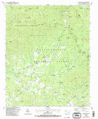
Historical Maps of Cherry Log Through Time
13 maps found
1935 Cashes Valley
Gilmer County, GA
1935 Tickanetley
Gilmer County, GA
1946 Cashes Valley
Gilmer County, GA
1946 Tickanetley
Gilmer County, GA
1947 Cashes Valley
Gilmer County, GA
1947 Tickanetley
Gilmer County, GA
1959 Dyer Gap
Gilmer County, GA
1971 Amicalola
Gilmer County, GA
1971 Dyke
Gilmer County, GA
1971 Webb
Gilmer County, GA
1988 Cashes Valley
Gilmer County, GA
1988 Dyer Gap
Gilmer County, GA
1988 Tickanetley
Gilmer County, GA