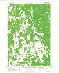
1966 Map of Casino
USGS Topo · Published 1967About this map
Casino and the nearby settlement of Bridgeman anchor this 1960s survey of southern Cass County, where a complex network of glacial lakes and wetlands dictates the local geography. The landscape is defined by its transition from the wooded uplands of Meadowbrook and Homebrook to the more open drainage basins of May and Fairview. Numerous small bodies of water, including the descriptively named Ghost Hill, Pale Lake, and Beaver Pond, are scattered across the terrain, connected by waterways like Sevenmile Creek and Mosquito Creek.
Find a feature on this map
28 named features on this map. Tap any name to fly to it.
Don’t see what you’re looking for? This feature index may not catch every label — zoom into the map to look around manually.
Map Details
Editions of this 1966 Casino Map
2 editions found
Other maps of this area

1916 · Pillager
USGS Topo · 1:62,500

1919 · Pillager
USGS Topo · 1:62,500

1919 · Leader
USGS Topo · 1:62,500

1953 · Brainerd
USGS Topo · 1:250,000

1954 · Pillager
USGS Topo · 1:24,000

1957 · Brainerd
USGS Topo · 1:250,000

1958 · Brainerd
USGS Topo · 1:250,000

1959 · Pine River SW
USGS Topo · 1:24,000
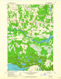
1963 · Motley SE
USGS Topo · 1:24,000

1963 · Motley
USGS Topo · 1:24,000