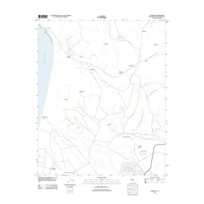
2012 Map of Casmalia
USGS Topo · Published 2012About this map
Vandenberg Air Force Base dominates the southern half of this coastal landscape, illustrating the significant military footprint along this stretch of the Pacific. To the north, the industrial character of the region is defined by the Casmalia Oil Field and Port Petrol, which speak to the area's long-standing reliance on petroleum extraction and transport. The small settlement of Casmalia sits at the junction of several rural roads, including Point Sal Rd and Black Rd, serving as a central point for the surrounding Casmalia Hills.
Find a feature on this map
32 named features on this map. Tap any name to fly to it.
Don’t see what you’re looking for? This feature index may not catch every label — zoom into the map to look around manually.
Map Details
Editions of this 2012 Casmalia Map
This is the sole edition of this map. No revisions or reprints were ever made.
Other maps of this area

1905 · Guadalupe
USGS Topo · 1:125,000

1905 · Lompoc
USGS Topo · 1:125,000

1942 · Point Arguello
USGS Topo · 1:62,500

1942 · Guadalupe
USGS Topo · 1:125,000

1942 · Lompoc
USGS Topo · 1:125,000

1942 · Lompoc
USGS Topo · 1:62,500

1942 · Santa Maria
USGS Topo · 1:62,500

1942 · Point Sal
USGS Topo · 1:62,500

1943 · Lompoc
USGS Topo · 1:125,000

1947 · Lompoc
USGS Topo · 1:24,000