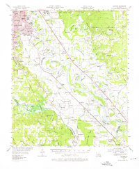
1955 Map of Caspiana
USGS Topo · Published 1976About this map
Shreveport and Bossier City anchor the northwestern edge of this mid-century landscape, where the Red River snakes through a complex network of bayous, chutes, and oxbow lakes. The transition from urban expansion to agricultural and industrial activity is clear, marked by the extensive footprint of Barksdale Air Force Base and the Red River Valley Agricultural Station. Along the river’s winding course, smaller settlements such as Caspiana, Taylortown, and Elm Grove serve as centers for a rural economy increasingly defined by energy extraction, evidenced by the Sligo Oil and Gas Field and Elm Grove Oil and Gas Field.
Find a feature on this map
159 named features on this map. Tap any name to fly to it.
Don’t see what you’re looking for? This feature index may not catch every label — zoom into the map to look around manually.
Map Details
Editions of this 1955 Caspiana Map
3 editions found

Other maps of this area

1932 · Bossier SE
USGS Topo · 1:31,680

1932 · Bossier SW
USGS Topo · 1:31,680

1932 · Shreveport SE
USGS Topo · 1:31,680

1938 · Arnsberg
USGS Topo · 1:31,680

1941 · East Point
USGS Topo · 1:31,680

1941 · Forbing
USGS Topo · 1:31,680

1941 · Bossier Point
USGS Topo · 1:31,680

1945 · Grand Cane
USGS Topo · 1:62,500

1945 · Greenwood
USGS Topo · 1:62,500

1945 · Mansfield
USGS Topo · 1:62,500