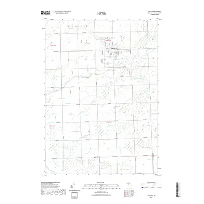
2019 Map of Cass City
USGS Topo · Published 2019About this map
The Cass River and its intricate network of tributaries define this part of the Thumb region, where the North Branch Cass River and South Branch Cass River converge near the established village of Cass City. This 2019 survey documents a landscape heavily shaped by agricultural drainage, with named features such as Deer Lick Drain, Wait Drain, and Gowing Drain crisscrossing the rural townships. The layout of Cass City reveals a concentrated street grid including W Main St and Seeger St, anchored by local landmarks like the Po and Elkland Cem on the eastern edge. To the south, the smaller settlement of Deford sits at the intersection of Deckerville Rd and N Kingston Rd. Genealogists will find value in the detailed locations of rural sites like Novesta Church and the adjacent Novesta Church Cem, providing precise coordinates for local history research.
Find a feature on this map
101 named features on this map. Tap any name to fly to it.
Don’t see what you’re looking for? This feature index may not catch every label — zoom into the map to look around manually.
Map Details
Editions of this 2019 Cass City Map
This is the sole edition of this map. No revisions or reprints were ever made.
Other maps of this area

1954 · Flint
USGS Topo · 1:250,000

1958 · Flint
USGS Topo · 1:250,000

1963 · New Greenleaf
USGS Topo · 1:24,000

1963 · East Dayton
USGS Topo · 1:24,000

1963 · Kingston
USGS Topo · 1:24,000

1963 · Cass City
USGS Topo · 1:24,000

1963 · Ellington
USGS Topo · 1:24,000

1963 · Shabbona
USGS Topo · 1:24,000

1963 · Gagetown
USGS Topo · 1:24,000

1963 · Owendale
USGS Topo · 1:24,000