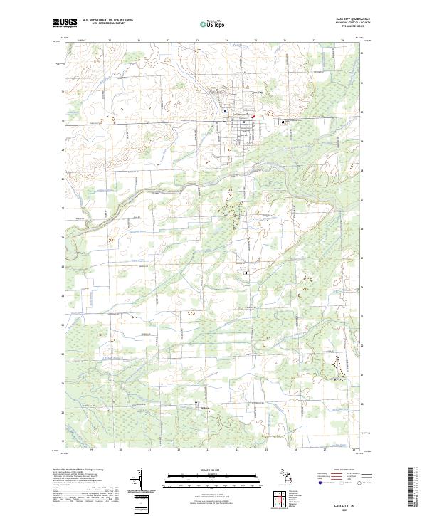
2023 Map of Cass City
USGS Topo · Published 2023About this map
Cass City serves as the primary hub of this agricultural landscape in the Thumb region of Michigan, where a complex network of engineered waterways supports the fertile plains. The confluence of the North Branch Cass River and South Branch Cass River highlights the natural drainage of the area, while dozens of named features like the Tuckey Drain and Wait Drain reflect the intensive land management required for local farming. To the south, the smaller settlement of Deford marks a crossroads near the North Branch White Creek. Genealogists and local historians can locate long-standing community landmarks such as the Elkland Township Cem on the outskirts of the main village and the Novesta Church Cem further south. The map provides a precise look at the township's layout, from the grid-like residential streets of Cass City, including Huron St and Garfield Ave, to the sprawling rural sections defined by family-named roads like Schwegler Rd and Dodge Rd.
Find a feature on this map
96 named features on this map. Tap any name to fly to it.
Don’t see what you’re looking for? This feature index may not catch every label — zoom into the map to look around manually.
Map Details
Editions of this 2023 Cass City Map
This is the sole edition of this map. No revisions or reprints were ever made.
Other maps of this area

1954 · Flint
USGS Topo · 1:250,000

1958 · Flint
USGS Topo · 1:250,000

1963 · New Greenleaf
USGS Topo · 1:24,000

1963 · East Dayton
USGS Topo · 1:24,000

1963 · Kingston
USGS Topo · 1:24,000

1963 · Cass City
USGS Topo · 1:24,000

1963 · Ellington
USGS Topo · 1:24,000

1963 · Shabbona
USGS Topo · 1:24,000

1963 · Gagetown
USGS Topo · 1:24,000

1963 · Owendale
USGS Topo · 1:24,000