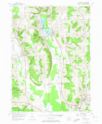
1954 Map of Cassadaga
USGS Topo · Published 1974About this map
The Lakes chain—comprising Upper Lake, Middle Lake, and Lower Lake—serves as the geographic heart of this mid-century New York survey. Along the eastern shores of Middle Lake, the community of Lily Dale appears at a time when the surrounding hills were defined by small settlements and institutional landmarks like the Newton Memorial Hospital. The landscape transitions from the residential clusters of Cassadaga and Sinclairville into the broader agriculture and forestry of the State Reforestation Area to the west. Industrial and transport connections are anchored by the New York Central railroad line, which follows the drainage of Cassadaga Creek south toward the Cassadaga Valley Central School. For local historians, the numerous burial grounds, including Greenwood Cem and Evergreen Cem, offer a clear map of the family lineages and township boundaries that shaped Chautauqua County in this era.
Find a feature on this map
50 named features on this map. Tap any name to fly to it.
Don’t see what you’re looking for? This feature index may not catch every label — zoom into the map to look around manually.
Map Details
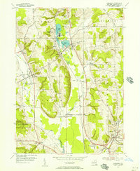
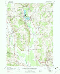
Editions of this 1954 Cassadaga Map
3 editions found
Other maps of this area

1900 · Dunkirk
USGS Topo · 1:62,500

1900 · Cherry Creek
USGS Topo · 1:62,500

1904 · Chautaqua
USGS Topo · 1:62,500

1905 · Jamestown
USGS Topo · 1:62,500

1941 · Cherry Creek
USGS Topo · 1:62,500

1941 · Chautauqua
USGS Topo · 1:62,500

1942 · Jamestown
USGS Topo · 1:62,500

1943 · Dunkirk
USGS Topo · 1:62,500

1954 · Chautauqua
USGS Topo · 1:24,000

1954 · Ellery Center
USGS Topo · 1:24,000