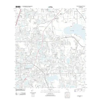
2012 Map of Casselberry
USGS Topo · Published 2012About this map
Elder Springs and Longdale anchor a landscape defined by an dense network of water bodies, reflecting the suburban expansion of Seminole County in the early 21st century. The map illustrates a developed region where residential growth meets historical landmarks like the Longwood Fire Tower and the Longwood Memorial Gardens. Transportation corridors such as N Ronald Reagan Blvd and General Hutchinson Pkwy facilitate movement between community hubs like Seminole Community College and commercial zones including the Florida Commerce Park.
Find a feature on this map
96 named features on this map. Tap any name to fly to it.
Don’t see what you’re looking for? This feature index may not catch every label — zoom into the map to look around manually.
Map Details
Editions of this 2012 Casselberry Map
This is the sole edition of this map. No revisions or reprints were ever made.
Other maps of this area

1953 · Oviedo SW
USGS Topo · 1:24,000

1955 · Orlando
USGS Topo · 1:250,000

1956 · Oviedo
USGS Topo · 1:24,000

1956 · Orlando West
USGS Topo · 1:24,000

1956 · Orlando East
USGS Topo · 1:24,000

1957 · Orlando
USGS Topo · 1:250,000

1958 · Orlando
USGS Topo · 1:250,000

1959 · Forest City
USGS Topo · 1:24,000

1962 · Orlando
USGS Topo · 1:250,000

1962 · Casselberry
USGS Topo · 1:24,000