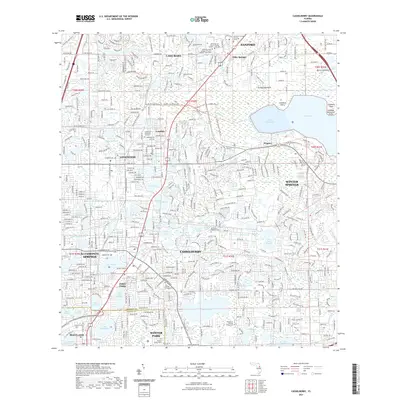
2021 Map of Casselberry
USGS Topo · Published 2021About this map
Casselberry and Winter Springs are the central focus of this 2021 survey, illustrating a dense suburban landscape north of the Seminole and Orange County line. The area is defined by an intricate network of water bodies, ranging from the expansive Lake Jesup and Soldier Creek Cove to dozens of smaller neighborhood lakes like Lake Kathryn, Lake Irene, and Lake Marie. These natural features are interspersed with institutional landmarks, including the Seminole State College of Florida and the University of Central Florida campuses.
Find a feature on this map
99 named features on this map. Tap any name to fly to it.
Don’t see what you’re looking for? This feature index may not catch every label — zoom into the map to look around manually.
Map Details
Editions of this 2021 Casselberry Map
This is the sole edition of this map. No revisions or reprints were ever made.
Other maps of this area

1953 · Oviedo SW
USGS Topo · 1:24,000

1955 · Orlando
USGS Topo · 1:250,000

1956 · Oviedo
USGS Topo · 1:24,000

1956 · Orlando West
USGS Topo · 1:24,000

1956 · Orlando East
USGS Topo · 1:24,000

1957 · Orlando
USGS Topo · 1:250,000

1958 · Orlando
USGS Topo · 1:250,000

1959 · Forest City
USGS Topo · 1:24,000

1962 · Orlando
USGS Topo · 1:250,000

1962 · Casselberry
USGS Topo · 1:24,000