
1961 Map of Casselton
USGS Topo · Published 1963About this map
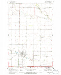
The railroad hub of Casselton dominates this Red River Valley landscape, serving as a critical junction where the Great Northern and Northern Pacific lines intersect. This 1961 survey illustrates the town's industrial and civic infrastructure, from the prominent Water Tank and local Reservoir to the Sewage Disposal Ponds at the edge of town. The grid of the prairie is defined by the survey lines of the Amenia, Casselton, Harmony, and Durbin townships, while the Rush River and Swan Creek meander across the flat agricultural expanse. Local history is anchored by St Leo Cem and a second Cemetery just south of the main settlement, alongside the Dalrymple Spur, which points to the region's deep roots in large-scale wheat farming and rail transport.
Find a feature on this map
19 named features on this map. Tap any name to fly to it.
Don’t see what you’re looking for? This feature index may not catch every label — zoom into the map to look around manually.
Map Details
Editions of this 1961 Casselton Map
2 editions found
Other maps of this area

1895 · Casselton
USGS Topo · 1:125,000

1897 · Casselton
USGS Topo · 1:125,000

1952 · Grand Forks
USGS Topo · 1:250,000

1953 · Fargo
USGS Topo · 1:250,000

1956 · Fargo
USGS Topo · 1:250,000

1956 · Grand Forks
USGS Topo · 1:250,000

1961 · Durbin
USGS Topo · 1:24,000
1961 · Casselton SE
USGS Topo · 1:24,000
1961 · Mapleton
USGS Topo · 1:24,000

1966 · Grand Forks
USGS Topo · 1:250,000