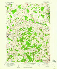
1943 Map of Cassville
USGS Topo · Published 1960About this map
The dairy and agriculture landscape of central New York is captured in high detail shortly after the onset of World War II. The Delaware Lackawanna and Western railroad serves as the primary industrial artery, connecting the valley settlements of Clayville, Cassville, and Paris Sta. The terrain is characterized by sharp elevations like Tassel Hill and Hardscrabble Hill, which separate the drainage of Sauquoit Creek from the southern headwaters of the Unadilla River system.
Find a feature on this map
41 named features on this map. Tap any name to fly to it.
Don’t see what you’re looking for? This feature index may not catch every label — zoom into the map to look around manually.
Map Details
Editions of this 1943 Cassville Map
2 editions found
Other maps of this area

1895 · Oriskany
USGS Topo · 1:62,500

1898 · Utica
USGS Topo · 1:62,500

1898 · Oriskany
USGS Topo · 1:62,500

1900 · Utica
USGS Topo · 1:62,500

1907 · Winfield
USGS Topo · 1:62,500

1907 · Sangerfield
USGS Topo · 1:62,500

1943 · Utica East
USGS Topo · 1:24,000

1943 · Hubbardsville
USGS Topo · 1:24,000

1943 · Cassville
USGS Topo · 1:24,000

1943 · Unadilla Forks
USGS Topo · 1:24,000